Skip to content
Stearns, Kentucky

Big South Fork NRA (Kentucky)

Riding AreaATVDirt BikeBuggy
Visit website

About

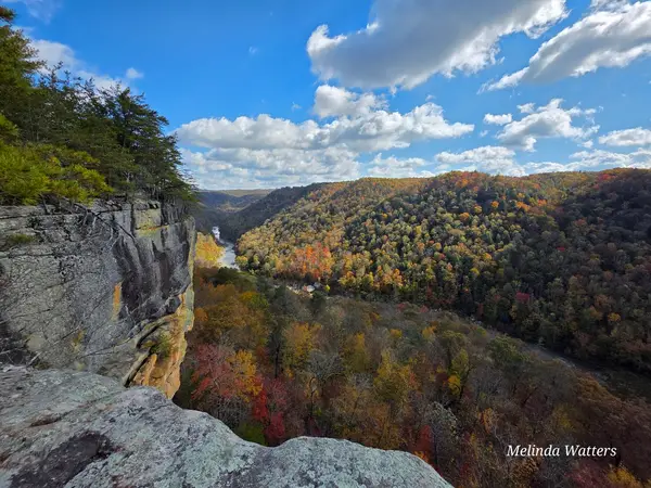
The Kentucky portion of Big South Fork National River and Recreation Area encompasses the McCreary County trailheads and OHV access points on the north side of the park: the staging points for KY-based riders that provide a distinct entry into the 125,000-acre NPS unit's 100-plus-mile OHV trail network, separate from the Tennessee trailheads near Oneida and Bandy Creek that serve the primary visitor flow from the south. The Kentucky OHV access is centered near Stearns in McCreary County, the small community at the edge of the Big South Fork gorge that was the company town for the Stearns Coal and Lumber Company operation that ran from 1902 through the 1980s. The Big South Fork Scenic Railway runs from Stearns into the gorge, the same gorge terrain that OHV riders traverse on the NPS ridge-top road system. The KY entry gives riders approaching from Lexington, Somerset, and the Cumberland River country a shorter drive and avoids the I-75 / Oneida routing. The OHV trail system from the KY side accesses the same ridge-top road network (ATVs, off-road motorcycles, and dune buggies permitted on designated ridge roads), and connects into the full park-wide trail map that extends into Tennessee. The Yamacraw Bridge area and Banshee Ridge OHV corridor are the primary KY-side motorized access zones. No OHV permit or entrance fee required; standard NPS rules apply. Blue Heron Visitor Center at the KY end of the Scenic Railway (606-376-5073) manages current trail status for the Kentucky district of the park.

Gallery

Park details

Vehicle Types
ATV, Dirt Bike, Buggy
Access
Public land

Trails at this park

Loads the full map of the trails at this listing. We leave it off by default so the page opens fast on mobile data.

Browse all trails

Current conditions

81Go/ 100 conditions scoreBest day: Sat, Sep 26 (98)

High today

82°F

Wind

8 kt

Gusts 12 kt

Rain chance

37%

Week ahead

Tue82°F37%
Wed80°F51%
Thu73°F18%
Fri77°F2%
Sat74°F0%
Sun75°F2%
Mon82°F2%

Forecast from Open-Meteo global models (NOAA & ECMWF).

Free tools

Your free outdoor toolkit

In your pocket

Take every trail with you.

Free, no account needed. Trail maps, live GPS ride recording that survives a dead zone, and every park in your pocket.

  • Every park and trail system in your pocket

  • Record every ride with GPS. Hands-free

  • File a ride plan and ETA. The app flags you overdue

  • GPS tracking that keeps recording past the last bar of signal

The Off Road Hubs app dashboard

For operators

Run an off-road business?
Get on the map for free.

Claim your free listing for a branded page and a spot in the Off Road Hubs app, then add bookings and digital waivers whenever you’re ready. No setup cost.