Maine
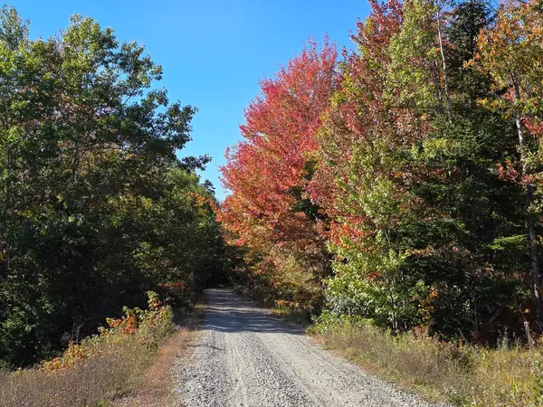
Down East Sunrise Trail
Riding AreaATV
About
Park details
- Vehicle Types
- ATV
- Access
- Nonprofit or club run
Around here
Around Down East Sunrise Trail
Loading map…
- Old County Roadmoderate · Mixed · 0.72 mi
- Unnamed trail in Down East Sunrise Trailmoderate · Mixed · 0.66 mi
- Valley Cove Trailmoderate · Mixed · 0.52 mi · Motorcycle, ATV, 4WD
- Unnamed trail in Down East Sunrise Trailmoderate · Mixed · 0.51 mi
- Unnamed trail in Down East Sunrise Trailmoderate · Mixed · 0.43 mi
- Unnamed trail in Down East Sunrise Trailmoderate · Mixed · 0.29 mi
- Timberland Acres RV ParkRV park · ★ 4.52.9 mi (opens in a new tab)
- Wild Acadia Camping ResortRV park · ★ 4.43.7 mi (opens in a new tab)
- Hadley's Point CampgroundRV park · ★ 4.48.5 mi (opens in a new tab)
- Bar Harbor / Oceanside KOA HolidayRV park · ★ 4.48.9 mi (opens in a new tab)
- Mt Desert Narrows CampgroundRV park · ★ 4.09.2 mi (opens in a new tab)
- Bar Harbor CampgroundRV park · ★ 4.510 mi (opens in a new tab)
Before you go
Data Source: Recreation.gov · Source: USGS GNIS · Source: National Park Service. No claim to original U.S. Government works. · Public land: USGS PAD-US · Forest roads: USDA Forest Service MVUM · BLM routes and areas: Bureau of Land Management (simplified for web display)
Current conditions
Today · Sun
71Go/ 100
CloudyHigh 46°F, low 36°FRain 51%Wind 11 kt, gusts 28
Air quality
12 Good
Acadia NP - McFarland monitor, 22 km
Forecast from Open-Meteo global models (NOAA & ECMWF). Air quality: Maine Dept. of Environmental Protection via EPA AirNow. Preliminary data, not verified.
More off-road parks in Maine

Also nearby
Other ways to get outside within about an hour of here.
Free tools