Skip to content
Wisconsin

Dead Horse Run Motorized Trail

Riding AreaATVSxS / UTV
Visit website

About

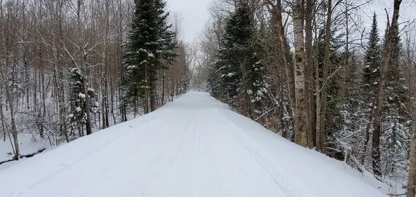
Dead Horse Run is a 63-mile ATV and UTV trail system threading through Sawyer and Ashland counties in the Chequamegon-Nicolet National Forest, running between the communities of Loretta and Clam Lake in the heart of Wisconsin's Northwoods, approximately 30 miles east of Hayward and 40 miles south of Ashland. The trail earns its name from the rugged logging-era history of this country, and the route's character reflects the original terrain: most of the system follows corridors about 14 feet wide with hard-packed, moderately rolling surfaces through a classic northern hardwood and mixed-conifer canopy of maple, oak, aspen, and birch. The cross-county routing connects two distinct communities and riding cultures, passing through habitat that supports whitetail deer, black bear, grouse, and eagles. Camp Loretta at the northern terminus serves as the primary staging area for trailered rigs, with parking large enough to accommodate multi-rig groups. The system connects to the Tuscobia State Trail to the south and the Flambeau River State Forest trail to the west, extending the rideable network beyond the 63-mile core. ATVs and UTVs up to 50 inches wide are the primary permitted class; check current width restrictions before visiting as they are periodically updated. A Wisconsin non-resident ATV/UTV trail pass is required; annual and short-term passes are available online. Primitive camping is available on national forest lands adjacent to the trail.

Park details

Vehicle Types
ATV, SxS / UTV
Access
Public land

Trails at this park

Loads the full map of the trails at this listing. We leave it off by default so the page opens fast on mobile data.

Browse all trails

Current conditions

97Go/ 100 conditions scoreBest day: Wed, Sep 23 (98)

High today

62°F

Wind

7 kt

Gusts 13 kt

Rain chance

0%

Week ahead

Tue62°F0%
Wed65°F0%
Thu65°F3%
Fri70°F1%
Sat63°F27%
Sun60°F25%
Mon71°F20%

Forecast from Open-Meteo global models (NOAA & ECMWF).

Free tools

Your free outdoor toolkit

In your pocket

Take every trail with you.

Free, no account needed. Trail maps, live GPS ride recording that survives a dead zone, and every park in your pocket.

  • Every park and trail system in your pocket

  • Record every ride with GPS. Hands-free

  • File a ride plan and ETA. The app flags you overdue

  • GPS tracking that keeps recording past the last bar of signal

The Off Road Hubs app dashboard

For operators

Run an off-road business?
Get on the map for free.

Claim your free listing for a branded page and a spot in the Off Road Hubs app, then add bookings and digital waivers whenever you’re ready. No setup cost.