Skip to content
Cadillac Pathway ORV Trails
Cadillac, Michigan

Cadillac Pathway ORV Trails

Riding AreaATVDirt BikeSxS / UTV
Visit websiteCall

About

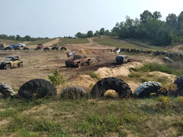
The Cadillac Pathway ORV trail system in the Pere Marquette State Forest encompasses approximately 25 miles of designated ORV single-track and a broader network of state forest roads open to ORV use in Wexford and Osceola counties around the city of Cadillac in Michigan's northern Lower Peninsula. The system serves the Cadillac, Manton, and Reed City communities and connects into the broader Michigan DNR state forest ORV trail network that extends across the northern Lower Peninsula. The terrain is characteristic northern Lower Peninsula forest land: second-growth mixed hardwood-conifer forest of red pine, jack pine, white pine, sugar maple, and red oak on the sandy glacial outwash soil; the rolling topography of the interlobate moraine landscape that gives the Cadillac region its defining rolling hills and lake country character; and the stream drainages of the Pine River and Clam River systems that cross the trail network. Cadillac Pathway is designed with dirt bike riders as a primary user: the single-track character, the technical turns, and the natural tight-corridor feel of the trail reflect the preferences of serious trail riders. Wider ATVs and UTVs are permitted on the forest roads but find the single-track sections restrictive. Seasonal closure from December through March aligns with the statewide DNR ORV season. The Cadillac area serves as a regional hub for OHV riders, snowmobilers, and outdoor recreation with full-service communities, lodging, and fuel infrastructure. Michigan ORV license required. DNR Cadillac Customer Service Center (231-775-9727) handles current trail status and maps.

Gallery

Park details

Vehicle Types
ATV, Dirt Bike, SxS / UTV
Access
Public land

Rider reviews

4.7on Google, 91 reviews
Read the reviews on Google Maps

Rating from Google.

Around here

Around Cadillac Pathway ORV Trails

Huron-Manistee National Forests1.9 mi2 mi

Data Source: Recreation.gov · Source: USGS GNIS · Public land: USGS PAD-US · Forest roads: USDA Forest Service MVUM · BLM routes and areas: Bureau of Land Management (simplified for web display)

Current conditions

Today · Sat

89Go/ 100

CloudyHigh 41°F, low 35°FRain 6%Wind 8 kt, gusts 16

Air quality

30 Good

Hoxeyville monitor, 28 km

Forecast from Open-Meteo global models (NOAA & ECMWF). Air quality: EPA Office of Atmospheric Protection via EPA AirNow. Preliminary data, not verified.

More off-road parks in Michigan

View all Michigan parks

Also nearby

Other ways to get outside within about an hour of here.